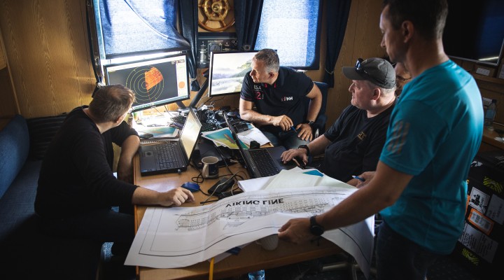
“The preliminary assessment of the wreck of MV Estonia and the surrounding seafloor was even more successful than we had dared to hope in our optimistic projections,” Rene Arikas, the director of the Estonian Safety Investigation Bureau, reported. “We managed to complete most of the planned surveys and will now begin a detailed analysis of the collected data, which should take around three months and which will determine how to proceed with the investigation. The next steps include digitising the figures and creating a 3D model of the vessel, conducting a ferromagnetic survey, and installing a current meter near the wreck.”
“We studied the geology of the seafloor around the wreck of MV Estonia in collaboration with Stockholm University,” said Sten Suuroja, head of the Department of Marine Geology and Geophysics of the Geological Survey of Estonia (GSE). “The GSE performed a seismoacoustic profiling survey on Stockholm University’s research vessel Electra af Askö. This method enabled the team to study the cross-section of the seafloor down to the hard basement rocks. The initial interpretation of the obtained data told us that the bow and stern of the wreck are resting on soft clay, while the mid-section of the vessel lies on a harder hill consisting of basement rocks and moraine. These conclusions are based on indirectly collected data, and more accurate conclusions will require a direct on-site investigation of the seafloor.”
According to Rene Arikas, throughout the survey period, the team’s operations were hindered by an unknown signal, the source of which has yet to be identified. “All of our survey equipment was affected by interference, which significantly reduced underwater visibility and due to which the surveys took longer than planned,” Arikas explained.
Despite the obstacles, for now, the team have managed to establish the following facts in the course of the preliminary surveys:
- 3D scanner and ROV surveys confirmed the existence of the hull-penetrating damage on the starboard side of the vessel that was also shown in the Norwegian documentary released in 2020. The damage covers an area of at least 4 x 22 metres, but the exact extent cannot be ascertained, as the damage is partly located under the hull. There is damage on both the exterior plating and, to a great extent, on the interior structures.
- The sub-bottom profiler survey confirmed that the wreck is for the most part resting on a soft layer of clay, but there appears to be a granite outcrop in close proximity to the wreck. Further investigation is needed to verify whether this could be the cause of the damage to the hull.
- The hinges of the vessel’s bow ramp are broken, the bow ramp itself has detached from the vessel, and the car deck is open. Establishing the cause of the separation of the bow ramp will require a more in-depth analysis.
- A number of deformations and cracks have been identified in the hull. For example, there is damage visible in the stern, which may indicate that when the vessel sank it collided with the seafloor stern first.
“In conclusion, the preliminary surveys can be said to have been a success thanks to the well-functioning international team, which included – in addition to Estonian and Swedish marine and geological experts – 3D scanner specialist Brian Abbot from the United States,” stated Rene Arikas. “During the preliminary survey period, our people were often working 18- to 20-hour days with only very short breaks. In addition, we received support from Finnish, Swedish, and Estonian authorities, universities, research institutions, and companies, as well as a large number of volunteers in Hiiumaa. For this, we extend our deepest thanks to them.”